Site Investigation
SITE INVESTIGATION
- Experienced professionals conduct soil, groundwater, and vapor intrusion investigations to delineate the nature and extent of contaminant plumes
- Confirm the absence or presence of contamination
- Perform due diligence for a property transfer or refinancing through Phase I/Phase II ESA
- Accurately present data and findings in technical reports that are easy to comprehend
Subsurface Investigations& Plume Delineation
Phase I & II EnvironmentalSite Assessments
Ground PenetratingRadar
Site Mapping & Drafting Services
Subsurface Investigations and
Plume Delineation
Creek Run has performed hundreds of subsurface investigations to determine the absence or presence of contamination and to define the nature and extent of contaminant plumes in soil and groundwater. A subsurface investigation is usually needed during property transactions or required by state regulatory agencies after the presence of impacted materials has been confirmed. A successful subsurface investigation and plume delineation depends on a thorough understanding of applicable regulatory requirements, soil conditions that influence contaminant migration, and client objectives.
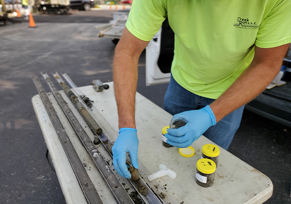
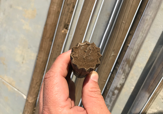
The extent of impacted soil is delineated by collecting soil samples for field screening and potential laboratory analysis using a Geoprobe direct push system or other appropriate technologies. The extent of impacted groundwater can be delineated by collecting samples from temporary wells placed in borings. If off-site sampling is required to accomplish project objectives, Creek Run can prepare the necessary documents and secure written access approval to adjacent properties. If the data indicates the potential for vapor intrusion of contaminants into on-site of off-site structures, Creek Run can perform a complete vapor intrusion investigation by collecting soil gas, crawl space, sub-slab, and/or indoor air samples as well as collecting data along utility corridors that may be a conduit for vapor intrusion. Creek Run’s experienced and knowledgeable staff uses the data collected from soil, groundwater, and/or vapor sampling to evaluate potential exposure pathways and determine what, if any, pathways require remedies.
Field sampling activities are conducted under the direct supervision of experienced, OSHA 40-hour HAZWOPER-trained Creek Run personnel. Soil and groundwater samples are processed by the Creek Run professional in accordance with the applicable regulatory requirements. Strict chain-of-custody and Quality Assurance/Quality Control (QA/QC) procedures are followed to guarantee sample integrity. Creek Run utilizes a select group of National Environmental Laboratory Accreditation Conference (NELAC) certified laboratories to ensure reliable analytical results and cost effectiveness.
If required by state or federal guidelines, Creek Run can design a groundwater monitoring network and supervise installation of monitoring wells to characterize groundwater flow and contaminant conditions. Typically, groundwater samples collected from temporary wells during initial investigation activities are evaluated to optimize the locations of semi-permanent monitoring wells in order to define the extent of impacted groundwater using the minimum number of wells. Based on a detailed scope of work, Creek Run will prepare detailed specifications and solicit quotes from qualified, OSHA 40-hour HAZWOPER-trained drilling subcontractors. As always, experienced Creek Run personnel supervise all phases of monitoring well installation and development.
At the conclusion of sampling and analysis activities, Creek Run will prepare a complete, concise report documenting all phases of the investigation. Creek Run has prepared Limited Subsurface Investigation, Initial Site Characterization (ISC), Further Site Investigation (FSI), Initial Investigation Report (IIR), Phase II Investigation Work Plan, and Phase II Investigation reports for various regulatory programs.
Phase I and II
Environmental Site Assessments
A Phase I ESA, typically required by a potential buyer or lender prior to conclusion of a transfer of ownership, is conducted to identify areas of recognized environmental conditions (RECs) at a commercial property. Creek Run prepares Phase I ESAs following ASTM Standard E1527-21. A Phase I ESA consists of three (3) main components: acquisition and evaluation of historical records and owner/operator questionnaires; site inspection; and preparation of a written report. A Phase I ESA report will be prepared upon conclusion of the historical review and site inspection.
A Phase II ESA is an investigation to confirm or negate the RECs identified during the Phase I process. Following review of the Phase I ESA and other available site information, a concise Phase II ESA scope of work is developed to ensure all areas of potential concern are properly assessed and client needs are fully addressed.
Ground Penetrating Radar
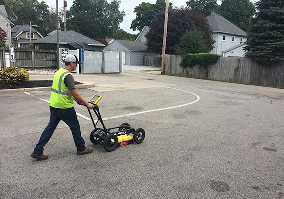
Using Ground Penetrating Radar (GPR), Creek Run has the ability to accurately locate and determine depths of subsurface entities without having to dig or drill. GPR is also a very useful tool in providing key information for the planning and execution of subsurface investigations. Creek Run uses a Sensors and Software Noggin® Smart Cart Ground Penetrating Radar (GPR) unit equipped with a 250 MHZ antenna. Using GPR we can:
- Determine and verify locations and depths of underground utilities;
- Identify utility corridors which may allow contaminants to migrate away from a release point;
- Clear an area of underground utilities that has been marked for soil borings;
- Provide accurate locations of underground storage tanks (USTs), including current tanks and tanks that have been closed in place;
- Determine the boundaries of current and former UST excavations; and
- Survey an area for the presence of unknown underground entities.
Site Mapping and Drafting Services
The Creek Run drafting department can provide mapping and drafting services to lenders, developers, consultants, and others who require clear, accurate, and user-friendly site maps. These services are provided under the direction of our Chief Draftsman, Randy Newton who has over 30 years of experience in the drafting and engineering fields.
All drawings are created using AutoCAD LT software. Drawings can be produced at the desired scale on 8 ½” x 11”, 11” x 17”, 18” x 24”, or 24” x 36” paper. Creek Run can use your standard border drawing and symbols, if available, or create them for you. Drawings and other information can be quickly transmitted electronically or delivered next day via Federal Express or UPS. Examples of mapping and drafting services Creek Run can provide include:
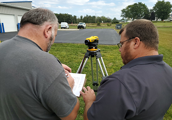
- Site Mapping – Documents are generated by an on-site visit to visually observe and field measure/photograph the subject property. If available, aerial photography, architectural/survey plans, legal description, etc., will be used to refine the site map. While not a legal survey document, site maps produced by Creek Run are highly accurate representations of the physical layout of the properties drawn with the degree of detail required to meet client needs.
- Environmental – Documents unique to environmental consulting are created by working directly with clients/project managers/field technicians to present information obtained from environmental investigation and remediation activities. Environmental drawings produced by Creek Run include: groundwater flow maps; soil and groundwater analytical summary maps; soil boring logs; well construction diagrams; and geological cross-sections.
- System Design/Mechanical – Design drawings presenting concise remedial and construction information are created by working closely with clients and project managers. Design drawings prepared by Creek Run include: conceptual design layouts; mechanical and plumbing details; building and trailer layouts; and completed as-built diagrams.
